Gaston Gravel


Caution! We do not provide turn-by-turn directions in our GPX files. Those are auto-generated by your bike computer and are usually less than 70% accurate. Learn more.
For help loading a GPX file onto your bike computer, go here.
DownloadHighlights & Remarkable Spots
Wapato Lake National Wildlife Refuge / Near Start
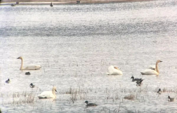
Just across HWY 47 to the east of Gaston, is Wapato lake.
In 2008, the U.S. Fish and Wildlife Service began purchasing land in the Wapato Lake bed to reestablish the historic wetland. Wapato Lake National Wildlife Refuge was officially established in 2013 as part of the Tualatin River National Wildlife Refuge Complex. With over 900 acres of continuous protected area, Wapato Lake National Wildlife Refuge is a fantastic place for a variety of wildlife, including the many migratory waterfowl that stop-over in the winter. The refuge is amazing year-round though; the changing seasons are reflected in the fluctuations of landscape and the wildlife who inhabit it.
After your ride, wander across the highway and test your birding knowledge!
Oregon Grape / ~ Mile 2.4
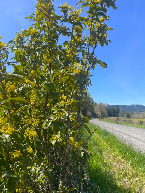
Oregon’s state flower, Oregon grape, is a large evergreen shrub, not a grape plant! Its bright yellow flowers emerge early in spring to provide pollinators with an early nectar source. It is also used for erosion control and medicinally in many ways including as a tea or tincture to support liver function.
There are several native varieties of Oregon grape, the easiest to identify due to its height will be Tall Oregon grape. Look for it on this route in hedgerows along fields.
Big Table Farm / ~ mile 4.5
There are many farmsteads nestled in the idyllic valleys around Gaston. One such is the regenerative farm, Big Table Farm. As per the owners, “Big Table Farm is a 70 acres farm in Oregon, where we raise animals and produce seasonal vegetables. On our farm, you’ll find free-range hens, pasture-raised pigs, goats, a team of draft horses, bee hives and grass-fed cows. We are building a managed intensive grazing system of farming that builds our soil, sequesters carbon, and moves us towards a healthy, sustainable and diverse farm.”
Oregon White Oak Trees / ~ miles 5, 6, 7, and 17.5
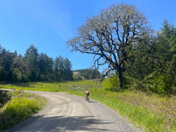
The native Oregon white oak (Quercus garryana) and its associated habitat was once widespread across the Willamette Valley. Now, as little as 3% of Oregon white oak habitat remains. Considered a keystone species, Oregon white oak provides food and habitat for over 200 wildlife species.
Along this route, you will see examples of large, standalone Oregon white oaks and clustered remnants of the once prolific Oregon white oak woodlands, often left gracing the tops of the hills.
To learn more, visit this link, and if you live locally and have the space, consider planting an Oregon white oak in your yard.
Hazelnut Orchards / ~ mile 10
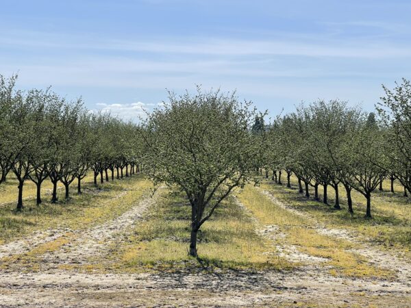
Hazelnuts (sometimes known as Filberts) are grown by more than 1,300 farms in Oregon ranking 13th in value for crops in the state. These farms grow 100% of the hazelnuts in the United States. Italy and Turkey are the only places in the world that grow more hazelnuts than Oregon.
Oregon State University has worked with local farmers to create new hazelnut varieties that grow well in the Oregon climate and are resistant to Eastern filbert blight. Prior to this, the blight devastated many hazelnut farms in the area.
Yamhill / ~ mile 12
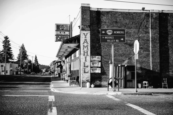
Yamhill’s location on Highway 47, between Gaston and McMinnville, has long made it a “pass through” town for travelers.In the late 1800s, though, it served as the starting point for a stagecoach run all the way to Tillamook. And in later years, it became a pleasant stop for train travelers going to Portland, thanks to a classy hotel.
Yamhill County was the second of the 4 original districts created by the Provisional Legislature in 1843. Its boundaries were drawn to include the area from the Willamette River west to the Pacific Ocean and from the Yamhill River south to the California border. The district consisted of 12,000 square miles; however, 12 counties were eventually created from Yamhill County leaving 709 square miles within its present borders.
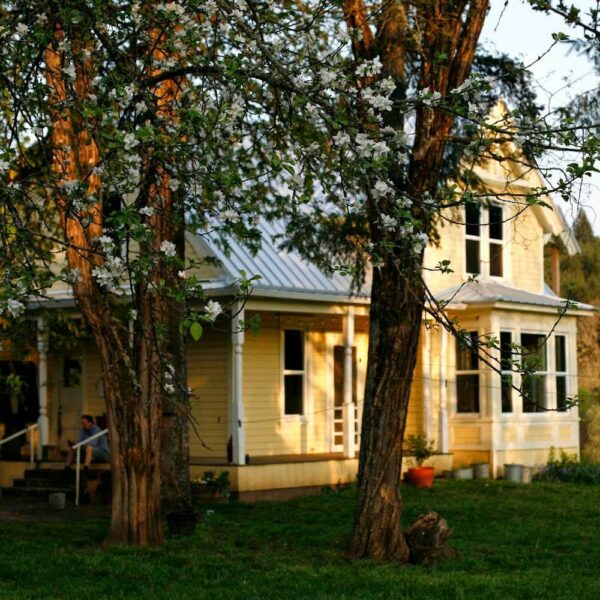
Lee Laughlin House / ~ mile 12
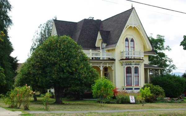
The “mansion on the hill” was built in 1879 by one of the prominent early citizens of Yamhill, Lee Laughlin, and is now on the National Register of Historic Places. The architectural style of the house is an adaptation of Italian Villa with Gothic Revival elements. Influenced by medieval design, the most commonly identifiable feature of the Gothic Revival style is the pointed arch, used for windows, doors, and decorative elements like porches, dormers, or roof gables. See if you can spy these distinctive features on the Lee Laughlin house.
Just across Laurel St and to the SE, is another historic building with similar architecture. Built circa 1898, the Yamhill United Methodist Church’s Gothic Revival features a common addition to churches built in the style: a Norman castle-like tower with a crenellated parapet or a high spire.
John Marion Bunn House / ~ mile 12.3
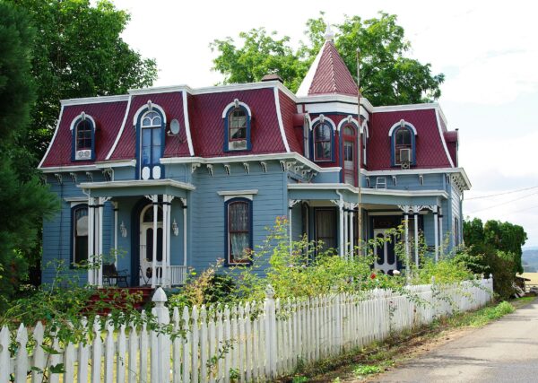
Another home on the National Register of Historic Places, is the John Marion Bunn House. The architecture is that of the Second Empire Baroque Style. So named for the elements in vogue during the Second French Empire. Second Empire architecture is typically characterized by a mansard roof, elaborate ornamentation, and a strong massing. The actual year of construction of the Bunn House is unknown with several accounts giving it as early as 1860 and others as late as 1888. Essentially intact, it is the only example of the Second Empire Baroque Style remaining in Yamhill County and it is among the rare examples of residential architecture in this style still standing in the Willamette Valley today.
Bailey Nurseries / ~ mile 14
Since 1977, Bailey Nurseries, a fifth-generation, family-owned business rooted in Minneapolis, Minnesota with a history spanning 110 years, has been running its vast operation near Yamhill on 1,100 acres of farmland. With three locations in the Pacific Northwest, Bailey employs around 325 workers on average. As you pass by rows upon rows of potted plants and greenhouses, you’ll truly grasp the scale of the nursery.
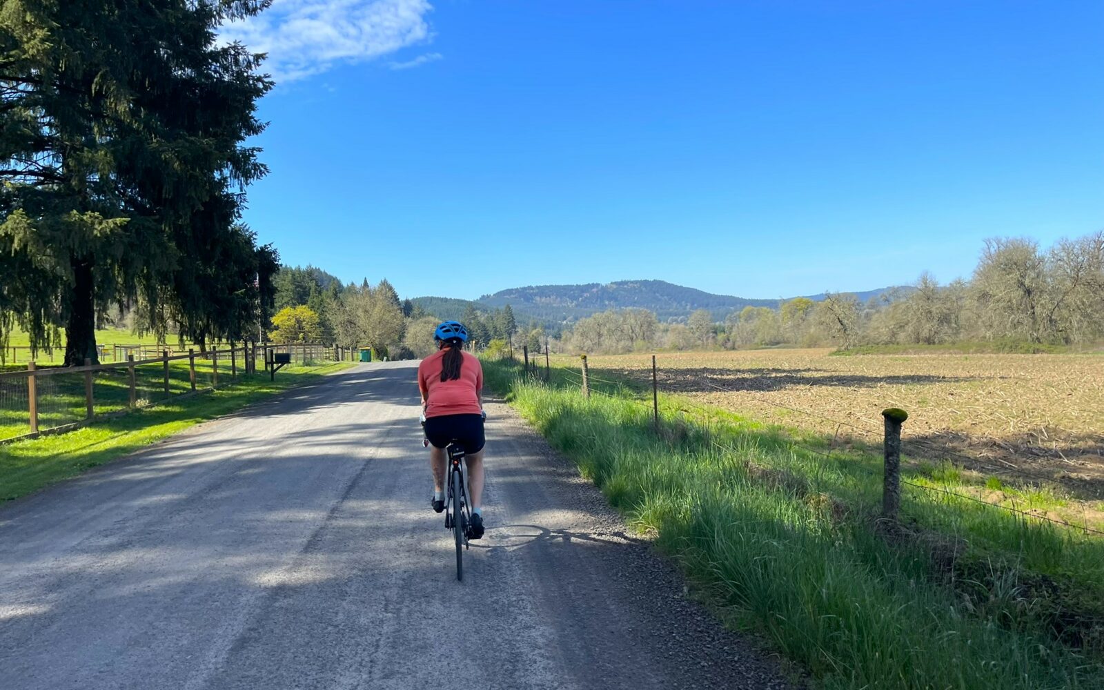
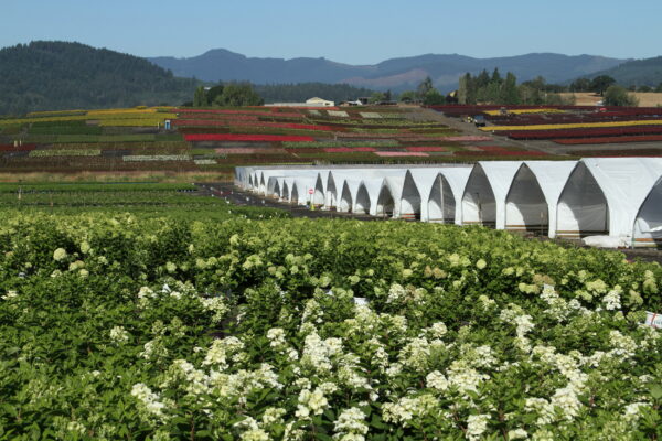
Grass Seed Fields / ~ mile 15
The Willamette Valley is a major hub for growing cool-season grass seed, contributing almost two-thirds of the total production in the United States. It’s often dubbed the “grass seed capital of the world.” Across nearly 1,500 farms in Oregon, grass seed is cultivated. Additionally, over 390 seed conditioning plants in the Willamette Valley process the seed for sale.
So, when you observe vast expanses of grass, like in this photo’s foreground, recognize that these aren’t just idle pastures but rather actively farmed fields.
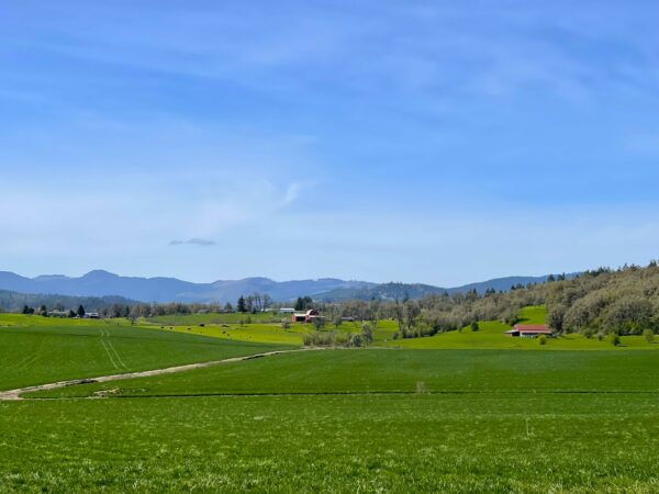
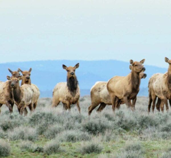
Elk Herds / ~ mile 17.5
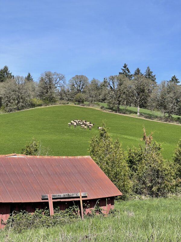
Every time I have ridden this route, I have seen Elk herds traipsing across the hillsides. While there is no guarantee that Elk will be visible every single time someone rides the route, the chances are still good. So keep you eyes open and sound levels low and you may just be treated to the sight of these majestic animals. Note that elk are more sensitive to human disturbance and vehicles than any other activity. Please keep space between yourself and any elk you see (~ 1000 yards or 0.2 miles). If they start to run, stop pedaling and let them escape in peace. Learn more about wildlife impact in this resource page we have put together.
Credits & Acknowledgements
This route was first posted by BobW on the RideWithGPS platform. We have modified the route to include “pass-bys” of several historic homes in Yamhill.
When We Like to Ride This
We love riding this in the spring when the trees are beginning to leaf out and the flowers are in bloom, in the summer when the days are long and the sun isn’t too hot, in the autumn when the trees begin to change color and the hills are ablaze, or even in the winter when rain is absent from the forecast and the visibility is high.
Terrain & Riding
Gravel roads gently curving through idyllic valleys and rolling hills, what more could you ask for?
Rural americana encapsulates this route. Rustic barns and small farmsteads. Goats, alpacas, cows, vineyards, orchards, and chickens. Remnants of the once prolific native Oregon white oak woodland still frost the hills and herds of wild elk leave their tracks across the fields. Turkey vultures and red-tailed hawks soar at head level, scouring the valley floors for prey.
The route is a mix of maintained paved and gravel roads. You will encounter local traffic on the gravel roads and between miles 13 to 14, the traffic can be heavy. Use caution! Giving room, a smile, and a wave when cars pass goes a long way to help keep relations between local vehicles and cyclists amicable.
The Start
Park on a side street by the Gaston Market, it is the best? Incredibly friendly people and well-stocked. They do allow customers to use the bathroom, so spare the neighbors and use the bathroom to change. Then, on your way out of the store, buy a snack, a drink, or a meal and support this wonderful local business.
Route Notes
There is enough traffic that having a rear-facing red blinky light is a minimum and something like the Garmin Varia is highly recommended.
This route is especially great for e-bikes, so take advantage of that and get out there with your e-bike and enjoy the scenery!
Route Options
This route can be combined with The Yamhill Loop to create a longer route.
Podcasts
Farm Talk with Nicholas Kristof
In this podcast, we talk with Nicholas Kristof, the award-winning columnist from the New York Times, and farm owner in the Willamette Valley. We talk about growing up on a farm, the challenges of farming, and some of the opportunities for rural and urban Oregonians to come together.
Be Informed!
Keep it Local! Learn More
Ridden and Reviewed by:

 Behind every route is scouting, mapping, storytelling, and a whole lot of pedal power.
Have you ridden this route? Got a question? Join the discussion!