Valles Caldera


Caution! We do not provide turn-by-turn directions in our GPX files. Those are auto-generated by your bike computer and are usually less than 70% accurate. Learn more.
For help loading a GPX file onto your bike computer, go here.
DownloadHighlights & Remarkable Spots
Jemez Mountains /~ throughout the ride
The Jemez Mountains form the southernmost tip of the Rocky Mountains, which stretch over 2,000 miles north into Canada. They hold no great natural landmarks, just a large area of mostly undisturbed forested wilderness, containing rocky peaks, meadows, streams, lakes and waterfalls. [The American Southwest]
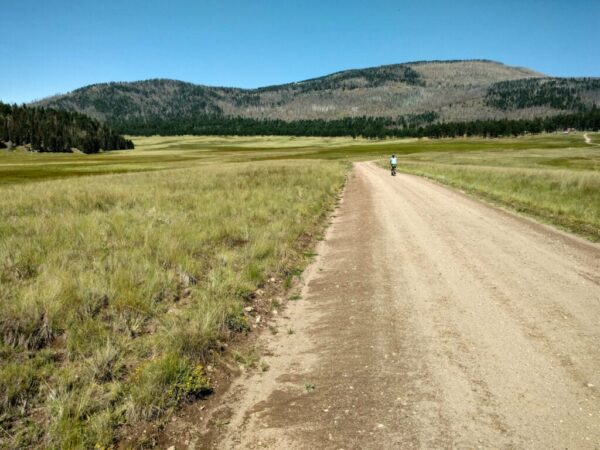
Valles Caldera / ~ throughout the ride
“A Diverse Landscape Born from an Explosive Past. About 1.25 million years ago, a spectacular volcanic eruption created the 13-mile wide circular depression now known as the Valles Caldera.” Use of Valles Caldera dates back to the prehistoric times: spear points dating to 11,000 years ago have been discovered. Several Native American tribes frequented the caldera, often seasonally, for hunting and gathering obsidian, used for spear and arrow points. [Wikipedia]
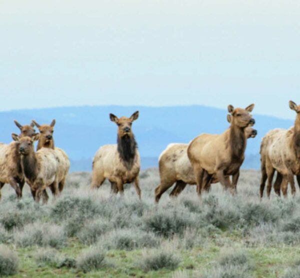
Valle Grande / ~ mile 1.5
“The beautiful Valle Grande is the largest grass valley in Valles Caldera. It is a unique grassy habitat and a perfect place to watch many species of animals in their natural environment, especially elk. It is the only valley of the preserve accessible by paved road.” [Trip Advisor comment]
“I call it my favorite meadow. The view was just spectacular with mystical layers of mist over the entire meadow, and bluish-grey mountains in the backdrop. From then on, every time we visit New Mexico, we have to stop by “my meadow” in paradise.” [Trip Advisor comment]
Historic Ranch Headquarters / ~ mile 17.5
“In 2000, the Baca Ranch was sold to the federal government for $101 million. Congress declared Valles Caldera / Baca Ranch a preserve, authorizing it to be run as a nonprofit ranch, overseen by a board of trustees. The goal is to continue operating the property as a working ranch while developing recreational opportunities for the public. As a result, the Valles Caldera has become a unique experiment in public lands management.
The headquarters buildings were the base and residential site used by the prior owners for large-scale sheep and cattle ranching operations since the 1860s. Today, preserve staff use the historic structures to interpret the colorful ranching history of the 88,900 acres once known as Baca Location No 1″. [New Mexico Nomad]
Redondo Peak / ~ mile 19.5
Redondo Peak is located entirely within the Valles Caldera National Preserve. It is the second-highest summit in the Jemez Mountains and is the most visually prominent peak in the range when viewed from the south from Albuquerque. From many other directions, it is less prominent or not visible, due to its location in the center of the Valles Caldera, well away from the caldera’s rim.
Redondo Peak is an example of the volcanic feature known as a resurgent dome. It was formed shortly after the caldera-forming eruption of 1.25 million years ago, but it is not itself an eruptive feature. The summit of the mountain is composed of tuff ejected by the caldera-forming eruption, rather than of subsequent volcanic ejecta. It is forested all the way to its summit. [Wikipedia]
Credits & Acknowledgements
Photos courtesy of Heidi and Derrick of Beers, Bikes, and Campfires.
When We Like to Ride This
Early fall when the colors just pop! However, it is ridable most of the year.
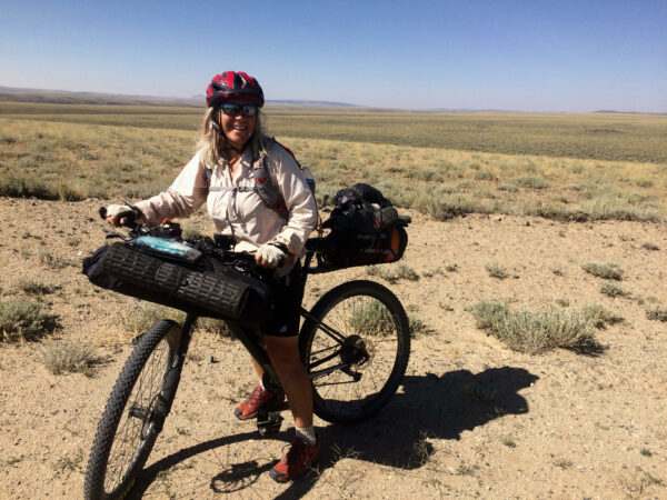
Terrain & Riding
This ride is a rolling hills, kind of a ride with an occasional steep and bumpy uphill. Views are amazing on the very first couple of miles, where you ride into the caldera. The climbing gradients are about 1 to 4%, with an occasional 5 to 6%. The terrain is a mix of high desert grasses with some sandy sections, medium size volcanic tuff and/or rhyolite gravel (soft, rounded and dusty to hard, angular and chunky). There are a few sections of the route where a forest burn occurred.
The ride covers a number of different habitats, including conifer forests, vast open grassy meadows, and steep flanks of the Jemez Mountains.
The Start
Small trailhead parking area along Hyw 4.
Food & Water
- None
Route Notes
By riding in this area, you will have an impact on wildlife, even if you don’t see the wildlife! To minimize your impact, we recommend the following guidelines:
a. If you see large game animals, give them space and distance to wander off. If they run, you have disturbed them and raised their anxiety level. (Stopping and giving space is by far the most important thing you can do.)
b. Limit your group size to 6 or less.
c. Keep your group together; limit the distance from the first rider to the last rider to 50 yards or less.For more information, see this Resource page that we have put together.
We recommend a red blinky light with rear looking radar detector (i.e. Garmin Varia)
Route Options
There are a number of other possible ride options through the Valles Caldera National Preserve. This eBike map shows some possibilities.
Be Informed!
Ridden and Reviewed by:

 Behind every route is scouting, mapping, storytelling, and a whole lot of pedal power.
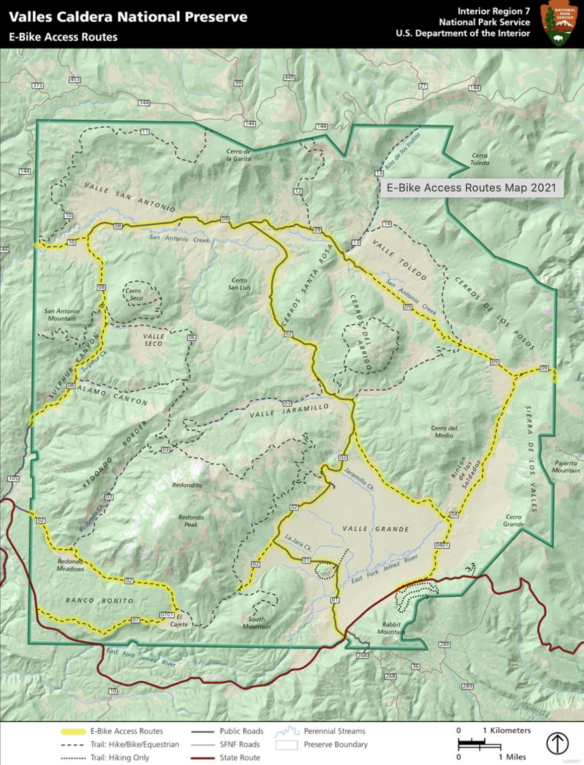
Have you ridden this route? Got a question? Join the discussion!