Wydaho One Hundred


 in Big Hole Mountains")


Caution! We do not provide turn-by-turn directions in our GPX files. Those are auto-generated by your bike computer and are usually less than 70% accurate. Learn more.
For help loading a GPX file onto your bike computer, go here.
DownloadHighlights & Remarkable Spots
Teton Mountain Range / Miles 7 to 27
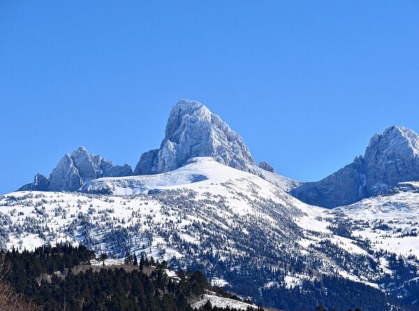
This stunning range lies within the Rocky Mountain System and is believed to have been formed by a combination of intense geological uplifts and faulting about 10 million years ago. The 40-mile-long range extends north and south along the Wyoming/Idaho state line, lying mostly within the Wyoming boundary.
Named after the French word “téton” meaning “nipple” or “breast”, the range is also called “Teewinot” in the Shoshone language by the Eastern Shoshone people, which translates to “many pinnacles” or “pointed mountains”. Photo credit: Anna Kirkpatrick
Ashton-Tetonia Rail Trail / ~ Miles 32 - 34
The Ashton-Tetonia Rail Trail runs for approximately 30 miles and crosses many major streams over trestle bridges along a former railroad corridor, which followed the route of the old Yellowstone Branch of the Oregon Short Line Railroad. After the railroad was abandoned, the corridor was converted into a unpaved recreational trail for hiking, biking, horseback riding, and other activities.
This route offers a short and brief excerpt of the trail; it is a welcomed reprieve from the rolling Teton foothills. If time allows, we encourage heading off route at mile 28.5 to see the Bitch Creek trestle bridge (map). It’s worth every bit of effort.
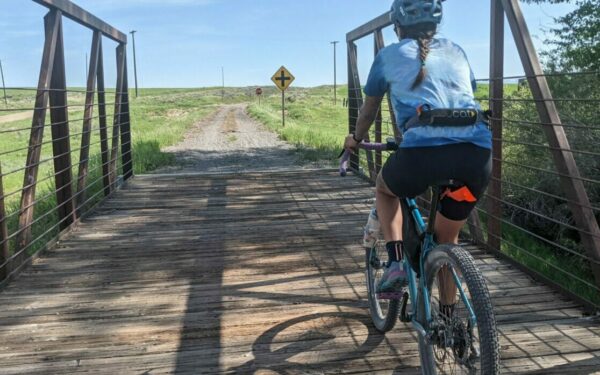
Harrops Bridge / ~ Mile 41.5
Named after a family of early settlers in the area, Harrop’s bridge was originally constructed as a wooden structure in 1916 to provide a mode of travel across the Teton River, linking remote agricultural communities for transporting goods, equipment, and livestock. Prior to its construction, the rural community members of Tetonia had to ford the river or use a ferry, a dangerous endeavor during high water and flooding.
Today the bridge is a popular stop for tourists and visitors offering a scenic overlook of Teton Basin and Teton Range. It is listed on the National Register of Historic Places and continues to hold cultural importance for Tetonia and the surrounding area.
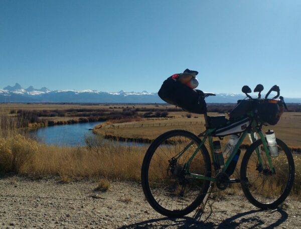
Teton River / Mile 41.5
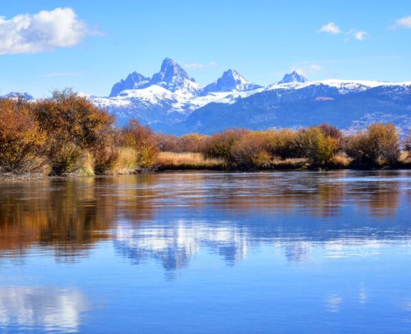
The Teton River is the last major free-flowing (undammed) river in Eastern Idaho. The river flows north through the Teton Valley basin, beginning near Victor at the confluence of Warm Creek and Drake Creek. It is fed by streams out of the Big Hole Mountains, Tetons and Snake River Range,
The river serves as crucial habitat for the native (and endangered) Yellowstone cutthroat trout, along with moose, trumpeter swans, and many other indigenous animals. [Photo credit: Anna Kirkpatrick]
Sandhill Crane Migration / Miles 66 to 72 (best viewing areas)
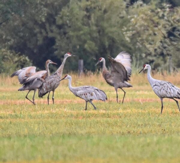
Sandhill Cranes are iconic in the Greater Yellowstone Ecosystem. Each fall large numbers from the Rocky Mountain Population congregate in Teton Basin while building up energy reserves for their long migration to wintering grounds. However, Sandhill Cranes can often be heard and seen from late spring and through the summer as they take advantage of the valley’s unique alignment of wetland habitat and farmland, which much of the route along the valley floor passes through. [Photo credit: Anna Kirkpatrick]
Victor / ~ Mile 81.5
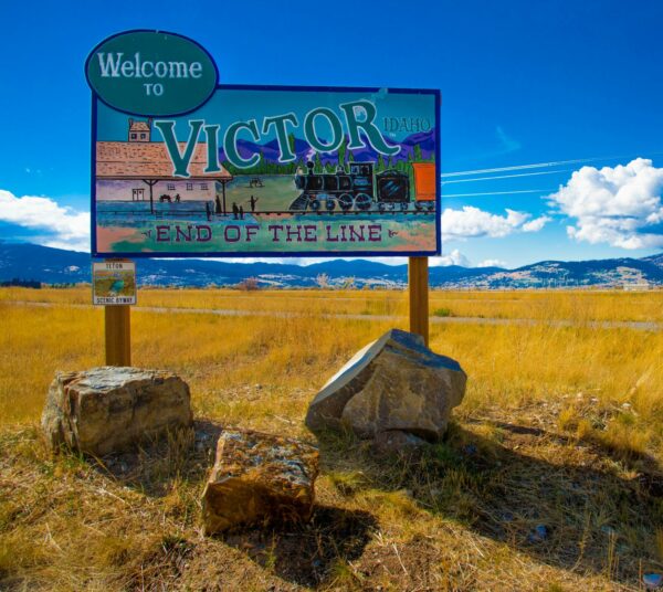
Victor served as a summer home for the Shoshone, Blackfoot, and Crow people in the 1700 and 1800s.
Victor was founded by Cache Valley Mormons in 1889 and originally named Ramond Village, only to be changed when the United States Post Office rejected the name. Victor was chosen for the local postman, George Victor Sherwood, who devotedly carried mail between Teton Valley and Jackson Hole over the infamous Teton Pass.
Victor became a more prominent town with the extension of the rail line from Driggs in 1913. Today that rail line is a paved bike path, with the Train Depot still standing and serving as a historic monument used by the community.
Battle of Pierre's Hole / ~ Mile 85
Present-day Teton Valley was originally called Pierre’s Hole named after “le grand Pierre” Tivanitagon a famous trapper, said to be of Iroquois descent, who flourished in this wild country. A brief, but significant battle took place shortly after the Rocky Mountain Rendezvous, an annual event where trappers, mountain men, and Native Americans assembled to peacefully trade goods.
From the recorded history of the Battle of Pierre’s Hole, one could assess that it originated from misunderstanding and a few poor decisions, and a mixing of allies between the Gros Ventre People, the American Fur Company & their alignment with the Rocky Mountain Company men & a couple of Iroquois people, resulting in a tragic loss on both sides. [Photo credit: Anna Kirkpatrick]
Idaho & Wyoming Stateline / ~ Miles 90 - 99
Stateline Road runs along the Idaho/Wyoming border for 9 miles, with gradual rolling terrain with views of the Teton Mountains, Big Hole Mountains and Teton Basin.
When We Like to Ride This
Early June to mid-October.
By mid-June, most of the snow is clear, and the roads are dry. June is also best for cooler daytime temperatures. By mid-July, wildflowers are in full bloom! Water is most prevalent in the spring through summer.
Late summer, mid-August to mid-September, will have warmer temperatures, more exposure, and infrequent water availability in creeks and streams through the valley floor. Late August and all of September is a great time for picking huckleberries. But, these months may also be smokey from wildfires.
September and October offer beautiful fall colors.
Terrain & Riding
Teton Valley offers a mix of buff gravel roads, rocky and rutted Forest Service mountain roads, and loose and dusty double-track through rolling agricultural land. Primitive agricultural roads “roads” make up for a small (about 5 miles) but demanding portion of the route. Expect unpredictable hazards such as ruts, rocks, and slick mud. Conditions vary remarkably depending on use and time of year. There are a couple of sustained climbs and a couple of potential hike-a-bike sections.
Badger Creek Backroad / Miles 3.5 to 6
Beginning with a slight, rolling incline out of Tetonia and along the Badger Creek backroad, the route starts to climb quickly as it progresses up the Rammel Mountain Road into the northern foothills of the Teton Range. Rammel Mountain Road is steep and rutted, which may require some hike-a-bike. While heavily treed, it provides brief glimpses of the Teton pinnacles.
Jackpine-Pinochle Rim / Miles 15.5 to 18.5
Jackpine-Pinocle Rime sits at the top of the northern foothills of the Teton Range. Heading north, the road is smooth and buff, with a low-angle descent passing through groves of lodgepole pines and vast open views of the interior of the Teton Range. The vast Jedediah Smith Wilderness foreshadows the iconic pinnacles: Grand, Middle, and South Teton, and Mount Owen, which sit in the Grand Teton National Park Boundary. Once turning west off the rim, enjoy a descent mixed with punchy climbs and tight switchbacks before dropping back into the valley.
Agricultural Lands / Miles 27.5 to 41.5
Shortly after descending out of the Tetons on Jackpine-Pinochle road, the route continues straight onto double-track for 2.5 miles with a steep drop in and out of the Teepee Creek drainage near mile 29.5. During late May or Early June, prepare for high water. Depending on the year, the crossing may be unpassable, in which case, reroute back to the gravel road at mile 28.5 and head west to follow Reece Road or the Ashton-Tetonia Rail Trail until reconnecting with the route.
The second double-track section begins near mile 37.5 after heading west of the small town of Felt (no services). This 2.5-mile section sees more agricultural equipment and irrigation, which may lead to mud, pools of water, and deep ruts.
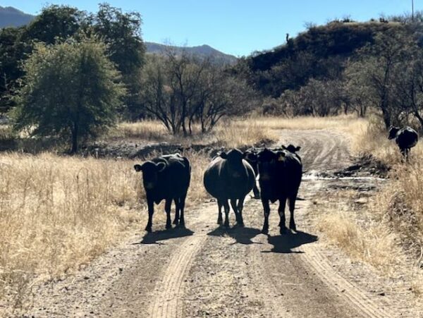
These county “roads” are primarily used by farmers to access their land for planting, maintaining, and harvesting their crops. Whether the roads are smooth and fast, or bumpy and slow, enjoy the rolling terrain and unique perspectives of the valley as you respectfully pass through these sections. And be sure to wave at the folks out working in their fields!
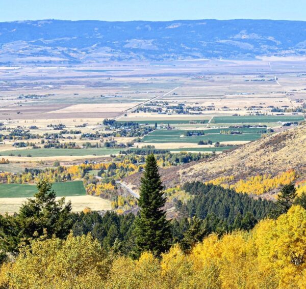
Packsaddle Bench / Miles 46 to 51
Packsaddle Bend sits above the valley just enough to offer unique views of the entire valley floor and the Teton Range, giving a sense of where you came from and where you’re headed. Most of the bench consists of open and typically smooth gravel roads through the farmland with a slight incline climbing up the sloping foothills along the northern portion of the Big Hole Mountains before dropping into Horseshoe-Packsaddle Canyon.
Horseshoe-Packsaddle Canyon / Miles 53 to 61
Horseshoe-Packsaddle Canyon conjoins two primary drainages and several creek tributaries, forming a stunning passage through the Northeast front country of the Big Hole Mountains. While the road passing through it is open to passenger vehicles, it’s seldom driven and contains multiple steep and technical sections. Use caution on descents and watch your speed around corners and tight switchback turns. Throughout the canyon are many dispersed camping zones with access to clean creek water.
Back on the Valley Floor / Miles 61 to 107
On the valley floor, county gravel roads with intermittent pavement hug the Big Hole Mountains as they round the valley’s southern end. These seldom traveled roads are gravel cycling gems with open views of the Teton Mountains and full emersion into the agricultural land. An optional paved path on the side of Targee Rd (just after mile 82) may make sense if the vegetation isn’t too overgrown. Be sure to look to your left and access the tunnel through the parking lot to bypass crossing the highway. Once in Victor, follow the paved bike path near Sherman Park and make your way toward Main Street, where there are plenty of food and beverage options.
Leaving Victor / Miles 81 to 83
Leaving Victor, you may take the unpaved frontage road or the paved bike path that parallels it. Note: you must yield to cross traffic on the bike path, while the frontage road has the right of way. Use caution crossing the highway at W 5500 S (mile 84.6), but enjoy this residential gravel road as it winds through empty lots with tall sagebrush. After a short bit on the paved E 5000 S road with a bike lane, enjoy one of the best backroad connector sections from S 2000 E to Stateline Road. Stateline Road consists of rollers, short paved sections, chunky unmaintained sections, and beautiful views of the Teton Range. Limited shade and water availability may challenge some through this portion of the route, especially during the late summer months.
After turning off Stateline Road, a series of turns connects Tetonia gravel roads into the highlands, where views of Teton Basin offer an unparalleled perspective of the whole valley before a fun descent back to the start.
The Start
Ashton-Tetonia Trail Parking Lot in Tetonia. There are two lots. A large lot (best for leaving a vehicle for several days and for larger vehicles) located off Egbert Ave. And a smaller parking area next to the trail and west of Ruby Carson Memorial Park. The park has a pavilion with picnic tables, indoor restrooms, and running water.
Important: Overnight parking is not allowed at Ruby Carson Memorial Park.
Food & Water
- ~ mile 0 or mile 107 / The town of Tetonia.
- ~ mile 81.5 / The town of Victor. There is Victor Valley Market, several restaurants and cafes, and Fitzgerald's Bicycles has coffee and a water spigot.
Route Notes
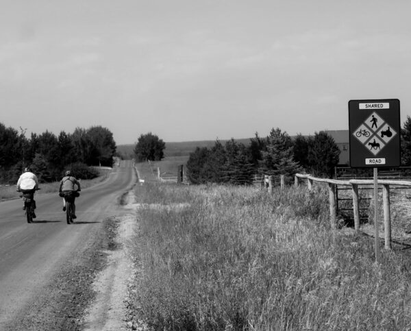
This route takes place almost entirely on roads open to passenger vehicles and agricultural equipment. It crosses Highways 32 and 33 several times and utilizes 4 miles of highway between miles 41.5 and 45. Follow the rules of the road, signal upcoming turns, ride with awareness, and always use front and rear blinking lights, especially in these areas.
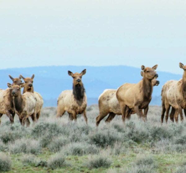
Wildlife is abundant all along this route and valley. It is not uncommon to see elk, moose, mule deer, coyote, fox, or even wolf cougar or bear along any of these roads. And don’t forget to for all the raptors, waterfowl, and sandhill cranes that call this valley home. The Tetons and Big Hole Mountains are home to grizzly and black bears.
While close wildlife encounters are seldom, always be aware of your surroundings when cycling. Give predators at least 100 yards and all other animals a minimum of 25 yards of distance.
Carry bear spray. Proper bear-proof food storage while camping is essential. Ride with awareness, make noise when in low-visibility areas, and respect the wildlife by giving them space.
For more information, refer to our resource page on Wildlife Impact before riding.
Many businesses in Teton Valley are closed on Sunday and sometimes Monday. Plan accordingly if you are relying on supplies and services in town.
The ideal bike for this route is a gravel bike or a hardtail mountain bike with a tire width of 45mm to 2.4″ for the most comfort and control.
Private land borders much of this route. Remain on the road through these areas and respect private property boundaries.
Dispersed camping is allowed along the route only on National Forest land, specifically along the Jackpine-Pinochle road and Horseshoe-Packsaddle road. Off-route dispersed camping can additionally be found in Darby Canyon.
Lodging/Camping is available en route at the courtesy of a route steward, Lynn Haney near mile 73 and Grove Creek Road. This is bike-in lodging only and is not available to those arriving by car like you would for AirBnB. Email lynn@haney.io ahead of time to reserve.
Additional lodging is available in Victor and along Stateline Road at the Teton Hostel Hideaway shortly after mile 93.
Route Options
This route has been traditionally ridden counterclockwise, however, it may be ridden in either direction. If riding clockwise, starting at Sherman Park in Victor would allow for a timely resupply/rest stop in Tetonia. Note that descending Rammel Mountain Road is rowdy!
Looking to mix it up with more technical and rugged terrain?
There is an option near mile 55 to leave Packsaddle Canyon, cross Packsaddle Creek, and link up singletrack through the Horseshoe Canyon Trail System.
Additionally, instead of descending the paved Horseshoe Canyon Road at mile 59, you can climb the Nickerson Grove Trail (double-track) and descend the rocky and unpaved Twin Creek Road, which turns into W 1000 S and connect back with the route at mile 64.5.
On the south end of the valley, south of Victor, the fast, fun, and flowy Southern Valley singletrack may be accessed via Pole Canyon (South 1000 West) at mile 79 or Sherman Springs Access Road just after mile 80. This singletrack can be looped by exiting at the Mike Harris Trailhead and passing through the recently added tunnel under the highway to Old Jackson Highway. This paved, but multi-user road then reconnects with the route at Baseline Road near mile 80.5.
Refer to Mountain Bike the Tetons Area Trail Map for more ideas and information.
Love Where You Ride! Learn More
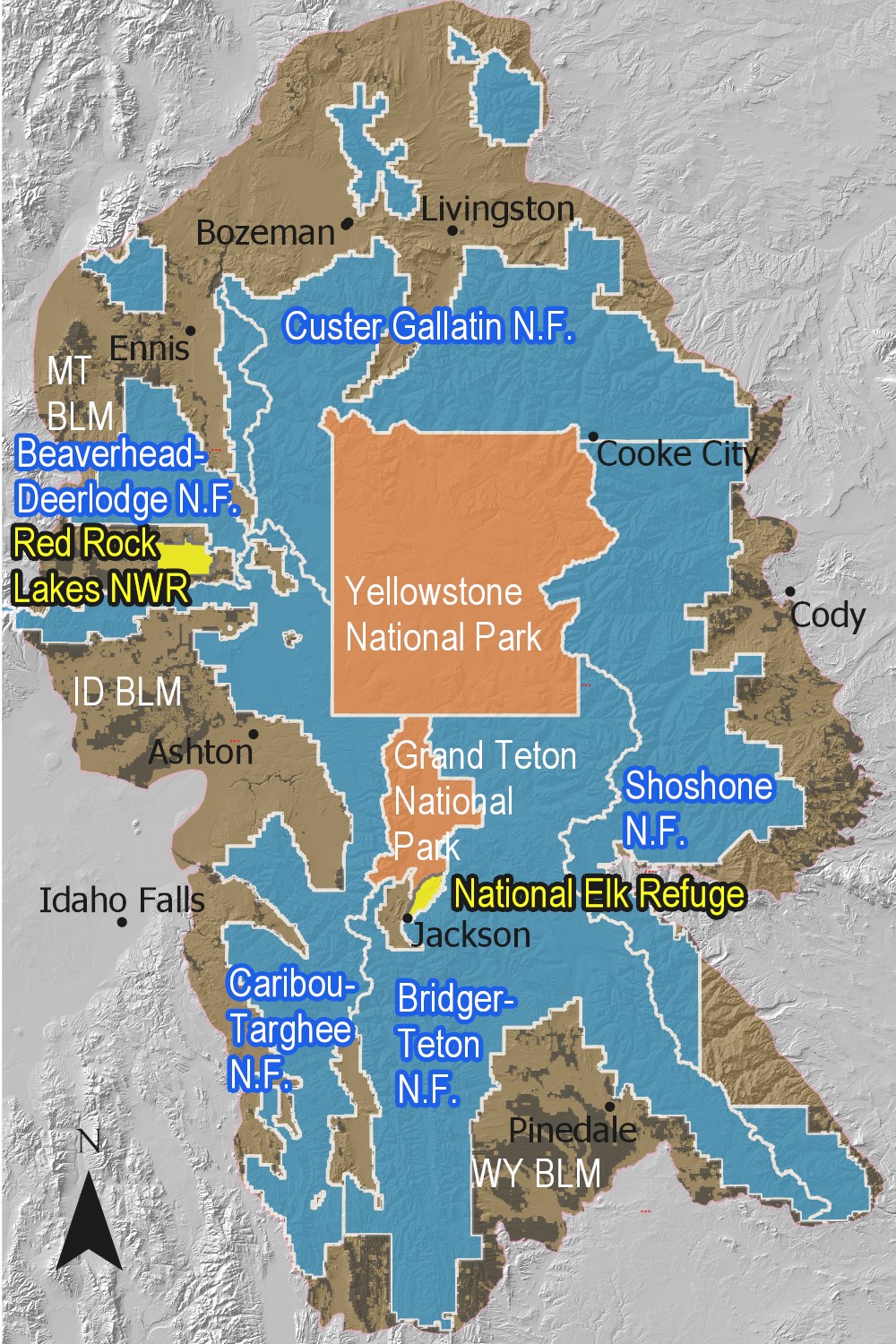 This ride highlights the western quadrant of the Greater Yellowstone Ecosystem (GYE), a unique and special valley that deserves our protection. The ecosystem covers 22 million acres across Wyoming, Montana, and Idaho, making it the largest intact ecosystem in the Lower 48 states. It includes two national parks, six national forests, ten distinct Wilderness areas, three national wildlife refuges, and state, federal, private, and tribal lands. The region is known for its diverse wildlife, including the largest free-roaming bison herd in the U.S. and one of the largest elk herds in North America. The landscape is varied, featuring active geyser basins, mountainous high country, pine forests, alpine meadows, sagebrush steppe, and grasslands.
However, the GYE faces challenges such as climate change, habitat fragmentation, invasive species, management across political boundaries, and changes in land use. Despite these challenges, the GYE is a vital part of the natural heritage and future of the U.S., providing clean air and water.
Videos
The Effects of a Changing Climate on Greater Yellowstone
Scientists are documenting significant changes in the amount of snow that falls in the Greater Yellowstone area as well as the intensity and timing of spring runoff. These trends could affect [...]
Podcasts
Tractors, Bulls and Lycra
In this podcast, we talk with Daarla K who is a rancher and farmer in northeast Oregon. She and her husband operate a 1000-acre farm that has been in his family since 1886. Learn how to safely pass by big tractors and combines, how to get through a cattle drive, and what aggressive behavior [...]
Be Informed!
Keep it Local! Learn More
Ridden and Reviewed by:

 Behind every route is scouting, mapping, storytelling, and a whole lot of pedal power.
Have you ridden this route? Got a question? Join the discussion!