Theodore


Highlights & Remarkable Spots
Salt River Valley / History
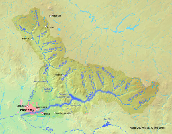
Around 200 B.C. the Hohokam Indians built an elaborate system of canals to irrigate their corn and cotton fields from the waters of the valley’s Salt and Verde rivers. Their efforts, however, were stymied by either periods of drought, which dried out the rivers, or times when heavy rains flooded their canals and washed away their desert homes. Their system of canals, is virtually the same system that the Salt River Project developed in the region.
Roosevelt Lake / most of the ride
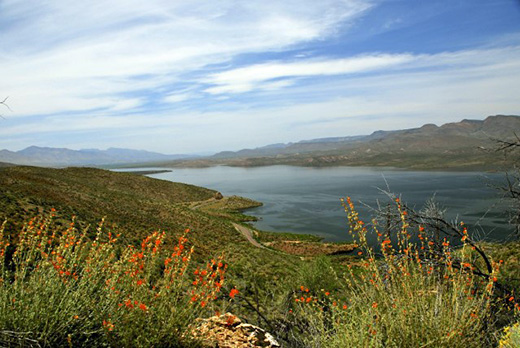
Theodore Roosevelt Lake was formed by the construction of a masonry dam on the Salt River in 1911, making it the oldest artificial reservoir in Arizona. The Lake is one of six reservoirs constructed and operated by the Salt River Project (SRP). It also has the largest storage capacity of the SRP lakes When the dam is in flood-control mode, the lake can store 2,910,200 acre⋅ft however, the U.S. Army Corps of Engineers requires all water over the conservation limit to be released from the lake within 20 days. [Wikipedia]
The Salome Jug Trailhead / ~ mile 9.5
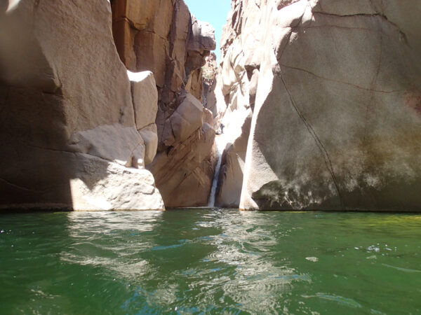
This marks the trailhead leading into “A very remote location so prepare yourself! Overall this place is like a waterpark in the middle of the desert! Enjoy and use caution! [LucasZ from Google Map Reviews]
This would make for an excellent bike + hike out and back route.
Power Canal & Diversion Dam / ~ Miles 33 to 40
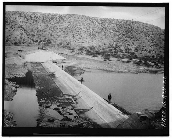
The nearly 20 mile long Roosevelt Power Canal and Diversion Dam were constructed in the years 1904-1906 to divert water from the Salt River to a hydroelectric generating plant that would provide the power to run the machinery used in the construction of Theodore Roosevelt Dam. The Power Canal/Diversion Dam system went into operation in 1906 and remained active after the completion of the Roosevelt project in 1911. In the decades that followed, the Power Canal was brought back online whenever the lake level would drop too low for water to enter through the dam. It was last used from 1946-1952. [Arizona Backcountry Adventures]
Roosevelt Dam & Visitor Center / ~ mile 50
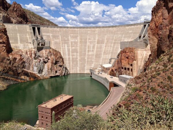
The Roosevelt Dam is considered the crowning achievement of Salt River Project (SRP). At its completion in 1911, Roosevelt Dam was the tallest masonry dam in the world at 280 feet. It was dedicated by U.S. President Theodore Roosevelt, for whom the dam and the reservoir are named.
In 1996, a massive expansion project to increase the capacity of the lake was finished. The dam was resurfaced with concrete and raised 77 feet, which increased the lake’s capacity by over 20%. Shortly after completion, the area entered into a prolonged period of drought, and it would be until 2005 before the new capacity was used, with the lake finally reaching 90% capacity. [Wikipedia]
Credits & Acknowledgements
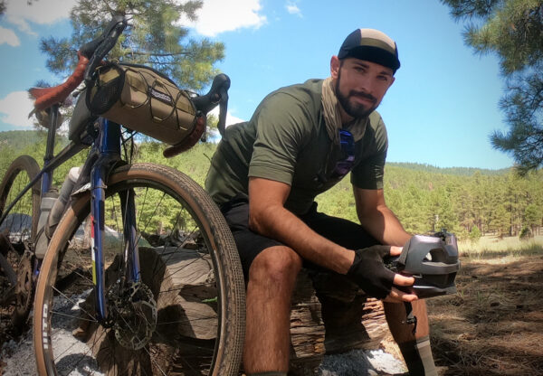
Route by AZ Gravel Rides (they have a full collection of Arizona gravel routes!). Photos by Wyatt Spalding.
When We Like to Ride This
October/November through April/May. Avoid this route in the summer as the heat and exposure would be too much. Additionally, after heavy rains, Tonto Creek can overflow and make the A+ road impassable – do not attempt to cross if it is flowing! Check with the Tonto Basin Ranger District if you’re unsure before making the trek (602) 225-5395.
Terrain & Riding
“I’ve heard this may be the best gravel in Central Arizona; although I have not ridden all the gravel it has to offer, I’ve been on quite a bit of it, and I agree with the sentiment.” [JoshV] A-Cross Road is an absolute pleasure to traverse, the views are consistently big and beautiful, and the landscape, both flora and fauna, is captivating.
Along with the standard fare of Sonoran Desert flora (Saguaro, Creosote, Prickly Pear, Palo Verde, etc.), the area is also home to a good number of Canotia Holacantha, also known as the “Crucifixion Thorn”, which you will wade through after descending the initial climb at about 2500 ft.
There is almost 5000 feet of climbing on the route, but the longest climb is just under 4.5 miles, gaining 1200 feet. Thus, expect a lot of rolling and undulating terrain. The gradients are generally less than 8%, but it does pitch up to 10% briefly in several spots.
The Start
The intersection of 188 & A-Cross Rd. There is a pullout on the left just as you jump on A-Cross Road.
Food & Water
- ~ Mile 40: Spring Creek Store (convenience store)
- ~ Mile 41: Mas Kitchen (restaurant)
- ~ Mile 49: Finch’s Waterfront Kitchen and Bar (restaurant)
Route Notes
We recommend a red blinky light with rear looking radar sector (like a Garmin Varia) for the paved sector. The winter months are very quiet, but as the weather warms up, the traffic will increase.
Tonto Creek, north of the lake, will be impassable by bike after a hard rain. DO NOT ATTEMPT!
You may want to air up your tires to road pressure at ~ mile 40.
There are numerous fee campgrounds around the lake and excellent dispersed camping along A-Cross Rd.
Route Options
You can bypass the rougher terrain mentioned in the difficulty section by continuing south on the 288 after A-Cross Road to the 188 intersection rather than going through the Diversion Dam area. This will add 1.5 miles and 450 feet of gain.
This route may ride better in the opposite direction, doing the paved highway section first and then tackling the gravel sector. We like the idea of a strong scenic finish. Let us know your thoughts!
Get Involved!
 A majority of this route is within the Tonto National Forest. One organization that does a significant amount of education and conservation work in the area is Friends of the Tonto National Forest. If you’re looking for a way to get involved and give back, this is one organization to take a look at.
Videos
Theodore Roosevelt Dam: Arizona’s Living Legacy
This is a must-watch video before doing this ride. It will truly connect you to the area!
Ridden and Reviewed by:

Have you ridden this route? Got a question? Join the discussion!