Rim Road 40


Caution! We do not provide turn-by-turn directions in our GPX files. Those are auto-generated by your bike computer and are usually less than 70% accurate. Learn more.
For help loading a GPX file onto your bike computer, go here.
DownloadWhen We Like to Ride This
I rode this route in early June, and the weather was perfect – 60 degrees when we started at almost 9 am and high 70s when we finished around 1 pm, getting into the hottest part of the day. This route should be good to ride from spring through fall.
Terrain & Riding
The beginning of the route throws you right into it and greets you with a 400 plus foot climb at 6%, to Baker Butte, from which you’ll descend nearly 500 feet. Another smaller ascent immediately after puts you at 5.5 miles where you’ll pop out of the thick Ponderosa pine forest and get your first exposure to the vast views of the Mogollon Rim. But alas, this is just a taste, and you’re back into the forest heading towards Kehl Springs Campground [mile 7.0], left to wonder how good the main course will be.
Kehl Springs Camp is located on the Tonto National Forest in a stand of ponderosa pines right at the brink of one of Arizona’s most awesome geologic features, the Mogollon Rim. Just a short distance from these shady campsites, the rim brings the Colorado Plateau to an end with a precipitous drop-off that plunges two thousand feet from forested highland to Sonoran desert. [AZ Camp Guide]
Up to this point, the road had quite a bit of washboard and a moderate amount of traffic. Just past Kehl Springs and FS 141, the road briefly turns south towards the edge of the rim where it begins to smooth out, the vehicle traffic abates, and the views become more constant. [micro-video] At mile 10.3, you descend a few hundred feet where you come to the East Verde River (it’s dry here), intersecting the Arizona Trail. Here [mile 11.8], you will see the “Battle of Big Dry Wash” historical marker and then begin a steep climb (almost 400 feet over 1.2 miles).
The Battle of Big Dry Wash was fought on July 17, 1882, between troops of the United States Army’s 3rd Cavalry Regiment and 6th Cavalry Regiment and members of the White Mountain Apache tribe. The location of the battle was called “Big Dry Wash” in Major Evans’ official report… [Wikipedia]
The road from this point [mile 13.0] to the turnaround point [mile 19.2] is rolling, but generally ascending. The ascents are smooth; the downhills are flowy, allowing you to gain good speed for when you begin to go back up. This section is fun riding with incredible views.
About a half-mile past FS 321, there is a distinct pull-out and vehicle turnaround to the right (south). A unique crevice [micro-video] can help you to identify this area, but I feel that it is pretty distinct (at FS 137, you’ve gone too far). Hang out here for a while, enjoy the most prominent views of the day at just about the highest elevation, and refuel as you prepare for a return trip that can be more challenging than the ride out … depending on how much you’ve got left in the tank! (19 miles, 1600 feet of gain, 2100 feet of loss).
The Start
AZ-87 Highway and the Rim Road intersection (room for parking – see pic).
Food & Water
- None.
Route Notes
I tackled this route on 43mm Panaracer Gravelking SK’s, but ran a little bit lower PSI than usual (40 front and rear) and was very comfortable. CushCore would be nice to allow for even lower PSI.
I rode this on a Sunday morning and experienced a fair amount of traffic during the first 5 miles or so of the route, basically between AZ-87 and Kehl Springs. Once past Kehl Springs, the traffic decreased dramatically. I first had this route mapped to turn around at Knoll Lake, but the road down to the lake is very rough, and the traffic is heavy in that area.
I would recommend a red blinky light with rear looking radar detector for the ride.
The route is remote, the entrance being about 10 miles from the nearest small town (Strawberry), and 15 miles to the nearest gas station (Pine). Cell service is hit or miss along the rim, with long sections of no service. Navigation is a cinch as you stay on the same road the entire time; it’s difficult to make a wrong turn. The road can be somewhat rough due to several washboard sections in combination with the elevation, but overall this is a route of moderate difficulty, I would say.
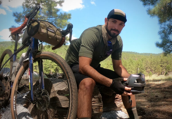
Ridden and Reviewed by:

 Behind every route is scouting, mapping, storytelling, and a whole lot of pedal power.
Have you ridden this route? Got a question? Join the discussion!