The Dirty Lemmon


Caution! We do not provide turn-by-turn directions in our GPX files. Those are auto-generated by your bike computer and are usually less than 70% accurate. Learn more.
For help loading a GPX file onto your bike computer, go here.
DownloadHighlights & Remarkable Spots
San Pedro River Valley / ~ Miles 28 to 41
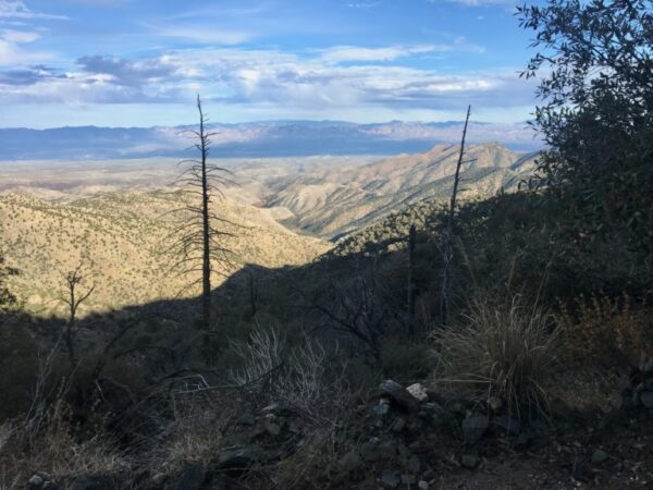
The San Pedro River valley is the most significant migratory flyway remaining in the Southwest. Nearly 400 species of birds spend part of their life-cycle along the San Pedro, and during peak migration, between 1 and 4 million birds are found there. Part of the Madrean Sky Island Archipelago, the entire valley’s exceptional richness provides a well-watered, verdant corridor for birds running from Sonora, Mexico to the Rincon / Catalina Mountains. [San Pedro River Valley]
Santa Catalina Mountains
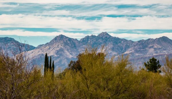
The Santa Catalina Mountains are a rugged range with steep slopes and deep canyons. The vegetation is strikingly diverse, with mixed conifer forests at the highest elevations and on north-facing slopes. Ponderosa pines predominate on many high elevation south-facing slopes. The higher elevation deep canyons, particularly those with running water, support lush hardwood forests of bigtooth maple, aspen, New Mexico locust, Arizona walnut, Gambel oak, and velvet ash. [US Forest Service]
Catalina Sky Survey / ~ Mile 83
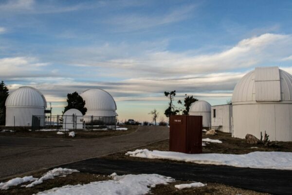
Catalina Sky Survey (CSS), on Mt. Lemmon, is a project to discover comets and asteroids and to search for near-Earth objects (NEOs). More specifically, CSS is to search for any potentially hazardous asteroids that may pose a threat of impact. [Wikipedia]
When We Like to Ride This
Fall and spring, when you have a bit more daylight and the temperatures are more moderate. We do not recommend this route in the winter as the Control Road can hold snow and ice. In the summertime, the route can be extremely hot, and water becomes a concern.
Terrain & Riding
Intense! More than 50% off-road…some of the most concentrated climbing I’ve seen, and what has to be one of the longest descents anywhere.
Ok, some quick details, this was a really dumb idea, and I wouldn’t recommend doing it alone, but I would recommend doing it if you can find someone who appreciates suffering and is a little dumb as well.
Start as early as possible!…possibly at dawn, to check out the sunrise. I started some time after 8 am and got back to my car in the dark. If I had any issues or mechanicals, I would have been in trouble because of the remoteness of most of this route. You’re basically in a valley (the San Pedro River Valley) that requires ~ 7500 feet of climbing to escape from….or backtracking 40 miles. I would consider warmer clothes and an emergency bivy if I did it again. (Note, I did this ride in mid-January).
Also, bring lights.
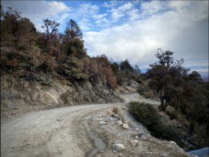
This route starts from the parking lot of Agua Caliente and, in a short time, heads up and over Reddington Pass. This area seems to be one of the gravel destinations for people riding from Tucson. It’s a switchbacky climb with some great views. This isn’t the smooth and relaxing gravel of the midwest or northeast; it’s chunky. I was running 2.2” tires.
After Reddington, it gets really flat for a long while, the San Pedro Valley River sector. The dirt turns to rough pavement [~ mile 41], and there was always a headwind. This would be a good spot to have a partner for some drafting.
There’s a resupply around mile 48 in the town of San Manuel. It’s a convenience store, so you can get some liquids and a snack…but for some reason, they don’t sell Combos. There was a non-operational food truck outside, so there is potential for a culinary surprise if you pass by on the right day!
After San Manual, the pavement continues west towards the backside of Mt Lemmon. This is the kind of climb that slowly grinds its way up, but it almost looks flat or even downhill at points. Maybe your eyes are fooled, but your legs certainly notice. These are some of the worst climbs.
I should mention that around mile 59 or so, there is a zip line place where the pavement turns to dirt that was advertising burgers, so that’s a potential stop as well. Though, I’m not sure I’d want to eat a burger right before the next leg of this route. This is also the boundary to the Coronado National Forest and the Santa Catalina Mountains.
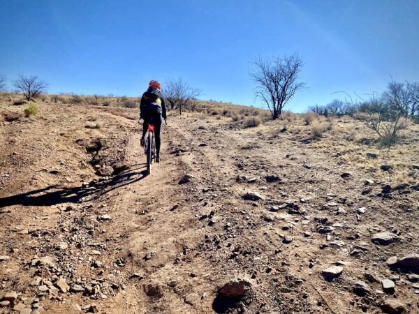
Once you’re on the dirt (the Mt Lemmon Control Road), it’s mostly up, except when it’s not, and there are some dicey downs in this area. After the rolling gravel, you get pretty close to Mt Lemmon, and it really starts to go up, 5500’ pretty much straight up [~ mile 70]. This just might be the most absurd climb I’ve done. It’s really windy, loose in points, chunky, and I got treated to some snow and ice. It’s relentless. It’s all rideable, but it still takes a long time. It feels like it took me 4 hours to go 15 miles.
At the top, you pop out on General Hitchcock Highway, also known as the popular paved road that heads up Mt Lemmon from the south. There are a lot of pro-roadies that train on this in the winter…and it does seem like it would be a fun climb and descent if it were a warm day. It was not a warm day. It was 30 up there, and I only had a sun shirt and minimalist wind shell…also, it was getting pretty dark, and I had some lights.
If you have the energy and daylight, make it to the official top by taking a right at mile 80 and finishing out the last bit of the climb: roughly 3.5 miles and 1300 feet of gain. Dusk was descending on me fast, so I gave this a pass.
The descent is about 7000 feet in 29 miles, so it takes a while. Also, there are people who like to race their cars up and down the highway, and there were rocks and snow in the road at points. It’s really steep and there is some incredible exposure in places. I’m sure I would have loved it if the circumstances were different. But I just clung to the bars, stopping occasionally to shake the numbness out and warm them up. The whole way down I was really questioning the decision to even start this ride. But I survived and am in a warm place, so I’m appreciative of the whole experience. This is type 2 fun…which is great, but that’s sometimes better to share with someone else.
The Start
Fall and spring, when you have a bit more daylight and the temperatures are more moderate. We do not recommend this route in the winter as the Control Road can hold snow and ice. In the summertime, the route can be extremely hot, and water becomes a concern.
Food & Water
- ~ Mile 47: The Salt & Pepper convenience store in San Manuel where water and snacks can be had.
- ~ Mile 78: In the resort town of Summerhaven there is a pizza shop and cookie shop. This requires about a 0.5 mile detour with a bit of elevation loss.
Route Notes
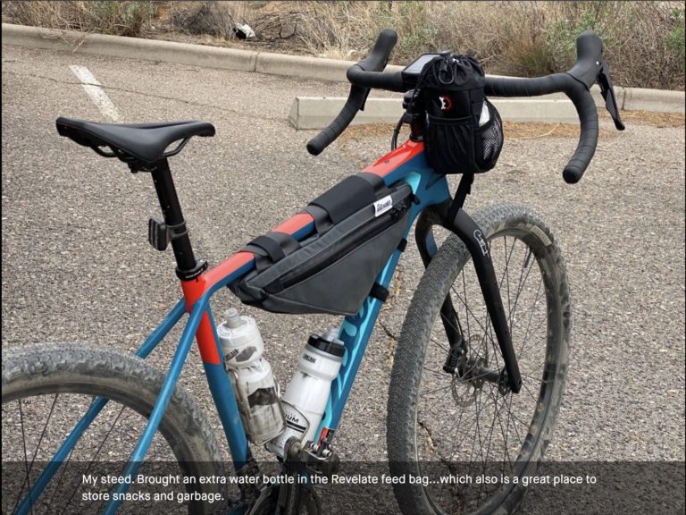
There is no perfect tire or bike for this route. There are fast paved sections and then there are some super-rugged gravel sections (see the comments.) At 50 mm tires is the sweet spot for most riders. However, some will prefer something larger like a 2.1″ mountain bike tire.
We recommend a red blinky light and a front facing white light for the descent from Mt Lemmon.
On the backside gravel climb of Mt Lemmon, if the gate is closed do not proceed. The gate is closed each year at ~ December 1 to allow for animal migration and for maintenance. Contact the Santa Catalina Ranger District of the Coronado National Forest for gate status.
Lael Wilcox, bad-ass cyclist and a resident of Tucson, has a great write-up on Bikepacking.com on this route. You can also check out our podcast with her here.
Route Options
If you skip the short dogleg to the Catalina Sky Survey station [at ~ mile 80], the route is then 107 miles and 10,700 feet of gain.
Be Informed!
Ridden and Reviewed by:

 Behind every route is scouting, mapping, storytelling, and a whole lot of pedal power.
Have you ridden this route? Got a question? Join the discussion!