Kendrick Mountain Wilderness


When We Like to Ride This
I am not super familiar with the area so it’s hard for me to say when is the best time to ride the route. Anytime from March to October should be good as far as weather is concerned (no snow presumably). I began at about 8 am and it was approximately 65 degrees and about 80 by the time I finished at around noon.
Terrain & Riding
Kendrick Mountain Wilderness, 6664 acres congressionally designated in 1984, is a beautiful area just north and west of the city of Flagstaff and part of the Kaibab National Forest (Williams Ranger District).
Kendrick Mountain Wilderness encompasses Kendrick Peak, one of the many peaks of the vast San Francisco mountain volcanic field located on the Coconino Plateau in north-central Arizona. Reaching an elevation of 10,418 … [US Forest Service]
From the Kendrick Peak trailhead parking lot, go south for 0.25 miles until intersecting FS 171. Go right, so that you are riding the route in the clockwise direction. FS 171 is a flat, smooth, enjoyable road that is a mix of dirt and gravel.
As you come to the end of FS 171, near Pumpkin Center, the forest gives way to open fields. Turn right onto FS144 for a quick jog. This area is known for the Pumpkin fire of May 24, 2000.
By June 9th, when the fire was contained 14,760 acres had burned. At the height of suppression efforts, 903 personnel were assigned to the fire. The fire continued to burn within containment lines until late August, when monsoon rains finally extinguished it. [Kendrick Peak Trailhead Kiosk]
Just before mile 9, turn right onto the “Old 90 road” (per the electronic version of the USGS Topo). The climbing begins, and the terrain turns to loose rock. In some sections, the rock is large and chunky. During the climb, I found myself having to paperboy, not because of the grade necessarily, but to maintain a decent line to keep moving. A ‘good” line does exist in all but a few stretches. The climb is stair-stepped, gaining 1000 feet in 5 miles. The steps are an average gradient of 6% with some steeper, but short sections. The summit of the climb brings you to Bull Basin, a large high alpine meadow.
From here the road drops quickly, losing 425 feet in 1.4 miles. The terrain is very similar to the climb – loose rock, sometimes chunky and therefore choosing your line is critical. Near the bottom of the descent, the road turns to smooth gravel again.
At mile 16 the road changes over to red cinder. From mile 16 on the route rolls up and down. 630 feet up. 450 feet down. The views are still big, with Humphreys Peak in the distance.
Note, from mile 16.7 to mile 23.3 the route is a weave of primitive forest service roads. The roads are listed as 767, 1910, 760, 9003G on the USGS Topo maps. And … what I have come to learn over time, is that the more digits in a road name the more primitive the road.
The views will slowly give way to to the cover of the forest. From here, it’s fast and easy to the finish.
The Start
Kendrick Peak Trailhead. Pit toilets.
Food & Water
- None.
Route Notes
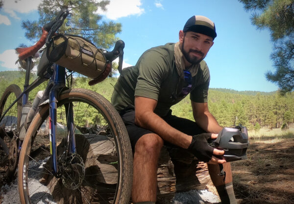
I tackled this route on 43mm Panaracer Gravelking SK’s at 45 psi in the rear and 40 psi in the front. An excellent tire, however, there were times on the FS 90 climb that I wished I had more rubber (650b x 2.1 inches maybe?) or even some suspension! Regardless of which tires you choose to run, my recommendation would be to air down for the latter half.
If you’re looking for more, consider doing the hike to the top of Kendrick Peak.
Ridden and Reviewed by:

Have you ridden this route? Got a question? Join the discussion!