Castle Hot Springs


Caution! We do not provide turn-by-turn directions in our GPX files. Those are auto-generated by your bike computer and are usually less than 70% accurate. Learn more.
For help loading a GPX file onto your bike computer, go here.
DownloadHighlights & Remarkable Spots
Castle Hot Springs
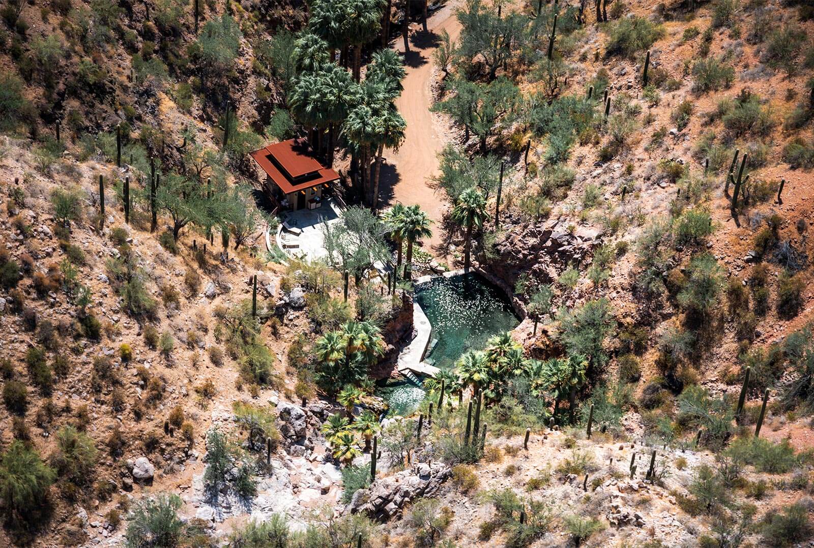
The Castle Hot Springs’ history dates back to the 1800s when it was discovered by the Yavapai Indians. They considered it a demilitarized zone where all were welcome to come and treat their wounds. In the 1880s, Frank Murphy purchased the springs and the adjacent land to build a health resort which was completed in 1896. The resort was popular throughout the 1920s, visited by celebrities and used as a rehabilitation center for injured veterans during World War II. The resort sustained heavy damages in a fire in 1976 but was restored in 2018 and open again to guests. [Wikipedia]
The Bradshaw Mountains
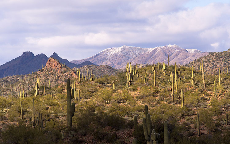
The Bradshaw Mountains, named after brothers Isaac and William D. Bradshaw, are a range located in central Arizona. The range was first settled by the Yavapai People, who mined copper from around AD 1100 to 1600. However, with the discovery of gold by the Walker party, the Bradshaws quickly filled with settlers mining for gold, silver, and copper. The range is home to a diverse biotic community and over 40 ghost towns, and much of it is on Prescott National Forest land. [Wikipedia]
Hell's Canyon Wilderness
Hell’s Canyon Wilderness contails nearly 10,000 acres of wild lands just outside of Phoenix. In 2008 a land developer transferred their 640 acre holding in the center of the area to the Wilderness Land Trust, preserving this unique landscape for us and generations to come. These lands make up part of the Hieroglyphic Mountain Range which encircle Burro Flats, effectively isolating the flats from the surrounding areas. This Sonoran Desert wilderness is home to flora and fauna including: saguaro cactus, paloverde, barrel cactus, ocotillo, mountain lions, bobcats, and venomous gila monsters. [Bureau of Land Management]
Lake Pleasant
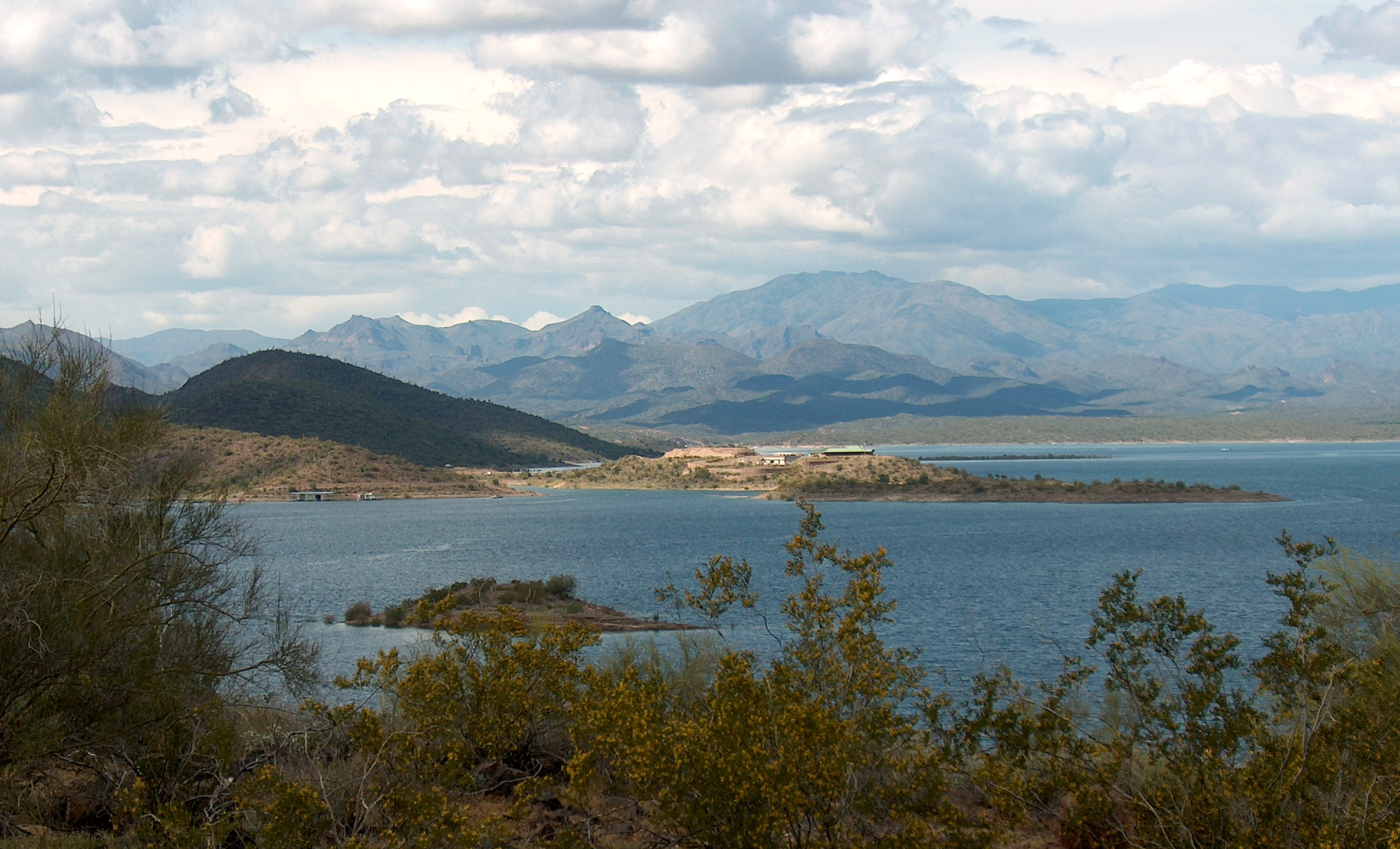
In 1927, the Carl Pleasant Dam, which at the time of construction was the largest multi-arch dam in the world, was originally filled by the Agua Fria River. In 1973, construction of the Central Arizona Project Aqueduct diverted water from the Colorado River to expand the original lake’s capacity, making it one of the most important resevoirs for the Phoenix metro. In addition, Lake Pleasant is a major water sports recreation center with boat docks, beach access, scuba diving, water skiing, jet skiing, sailing, and windsurfing. [Maricopa County Parks & Rec]
Credits & Acknowledgements
Special thanks to local rider Julio Devora for sharing this route with us.
When We Like to Ride This
Mid-week and not during the holiday season. This route can have heavy OHV/side-by-side traffic on the weekends.
We would recommend avoiding this route in the summer due to the lack of shade and water stops, and possibly avoid riding this right after a heavy rain event. There are a few well packed washes you will cross that could easily fill up during, or right after a heavy rain.
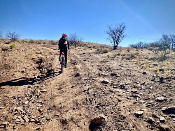
Terrain & Riding
This route is mapped out as a lollipop on 99% gravel roads and one section of paved relief on its stem. The short paved bridge takes you across an overflow section of Lake Pleasant, which has been dry and empty for the past few years (don’t let the Google satellite view fool you). Seven miles into the route you will come across Castle Hot Springs Resort. This is a good turn around point for those looking for a shorter ‘out and back’ route.
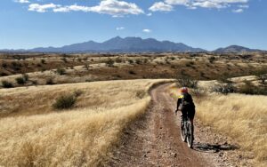
After passing the resort, much of the beauty of the ride is still to come. About 2 miles further is the first right hand turn, on Chanpie Road. The “T” in the road is well marked with signage right after a cattle guard. The Chanpie Road section at mile marker 9 starts the climbing highlight of the ride with winding narrow climbs that often exceed 10% grade and reward you with views of seemingly endless peaks and valleys, a defining characteristic of the Bradshaw Mountains. The second right turn, on Cow Creek Road at mile 13, is also well marked and hard to miss. This section is your payout for much of the climbing you’ve accrued so far. It is a long descent with stunning views of desert cliffs and valleys. If you ride this section in the afternoon, the setting sun to your right will make the teddy bear cholla glow in the sunlight. At about mile 20 you will reach the stem of the lollipop, but make sure you save your legs for a few more steep climbs as you head back to where you started.
The technical riding on this route would be rated as moderate. Most of the road is well graded and packed in. Some of the technical sections include short washboard sections and steep descents with large rocks to maneuver around.
The Start
Parking area on the side of the road where the pavement ends.
Food & Water
- None
Route Notes
The road conditions can change remarkably from ride-to-ride depending on weather, maintenance, and usage. At times, you may encounter heavy washboard. Go with big tires and low air pressure.
Route Options
For a shorter ride of approximately 14 miles, you can do an out and back and turn around at Castle Hot Springs Resort at the 7 mile mark.
Videos
What is a Wilderness Area? Why should I care?
An exploration of what the wilderness designation means, with a special focus on The Wilderness Act's protection and preservation of our wild lands.
Be Informed!

Have you ridden this route? Got a question? Join the discussion!