Myrtle Tree


Caution! We do not provide turn-by-turn directions in our GPX files. Those are auto-generated by your bike computer and are usually less than 70% accurate. Learn more.
For help loading a GPX file onto your bike computer, go here.
DownloadHighlights & Remarkable Spots
Oregon Champion Myrtle Tree Trail / ~ Start
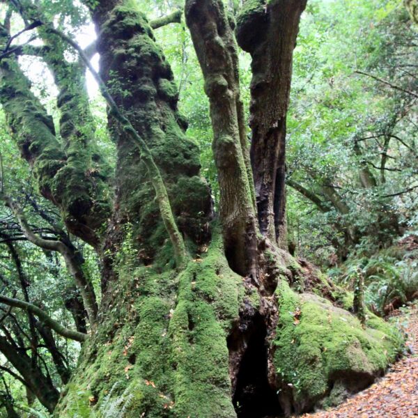
“Myrtle trees have the ability to regenerate by seeding, sprouting from the base of the tree, or if blown over, the limbs may grow vertically to become new trees,” the guide says. “Myrtle trees also have large root masses which help them regenerate after fire.” [Oregon Statesman]
The 1/2 mile trail ends at one of the world’s largest myrtle trees and apparently the largest in Oregon. It is around 400 years old, 88 feet tall, 42 feet in circumference with a canopy 70 feet wide.
Lobster Creek Watershed / ~ Miles 0 to 10
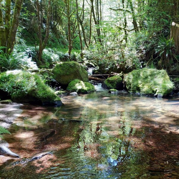
The Lobster Creek Watershed, a major tributary to the Lower mainstem of the Rogue River. The watershed comprises an area managed by the United States Forest Service (USFS) and private timber interests. Tributaries to the Lower Rogue represent high quality fishery habitat and are the primary source of salmonid production in the Lower Rogue.
The Lower Rogue mainstem serves primarily as a migration corridor. Mainstem tributaries provide important spawning and rearing habitat and provide thermal refugia in the already heated mainstem. [Ref: Oregon.gov]
Lake of the Woods Lookout / ~ Mile 20
“At an elevation of 3,419 feet, Lake of the Woods Lookout provides a sweeping panoramic view, with vistas to the Pacific Ocean, the Kalmiopsis and Wild Rogue Wildernesses, and the Wild and Scenic Illinois and Rogue River canyons…The lookout, a one-room cabin with windows that provide 360-degree views, accommodates one to four people. It is equipped with a propane stove, lights, and is furnished with a table and two chairs, a double bed, foot stool, broom and fire extinguisher…An outhouse is located near the lookout…It was first located on Barklow Mountain on the Powers Ranger District. The R6 (Flat Roofed) cabin, originally a “ground house” (the lookout cabin was built on the ground, not on top of a tower), was flown by helicopter to the present location and placed on an eight-foot tower with a catwalk in 1974. Lake of the Woods Lookout was staffed during fire seasons from 1974 to 1996.” [US Forest Service]
Wild and Scenic Rogue River / ~ Mile 33 to Finish
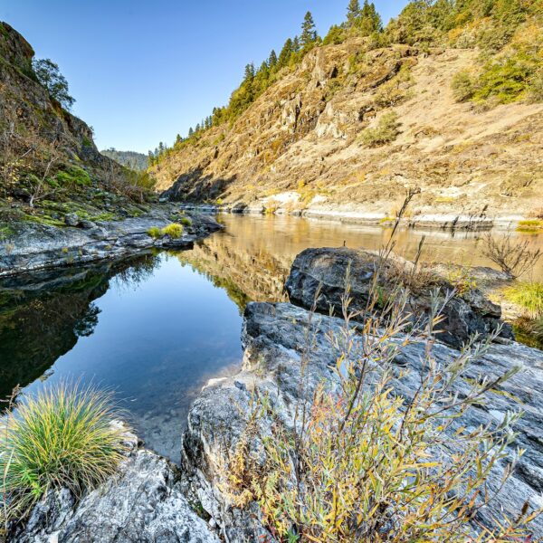
“From its source in the high Cascade Mountains in southwestern Oregon near Crater Lake National Park, the Rogue, one of the longest rivers in Oregon, tumbles and flows more than 200 miles, entering the Pacific Ocean at Gold Beach … The lure of gold in the 1850’s attracted a numbers of miners, hunters, stocker raisers and subsistence farmers. Conflicts between white settlers and Native Americans culminated in the 1855-56 Rogue River ‘Indian War,’ after which Native Americans were relocated to reservations. For settlers, life in the Rogue Canyon was difficult and isolated. While gold mining operations were extensive, overall production was low. The remnants of mining, such as pipe, flumes, trestles, and stamp mills can still be found.” [National Wild and Scenic Rivers System]
Lobster Creek Bridge / ~ Mile 55
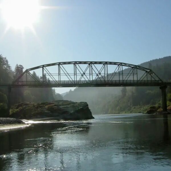
Nice viewpoint of the Rogue River.
When We Like to Ride This
Mid-spring through late fall.
The Start
Myrtle Tree Trail parking lot.
An alternative spot with flush restrooms and water is the Lobster Creek Campground. They have a small parking lot for day use. This is just before the Lobster Creek bridge over the Rogue River. North side of Jerry’s Flat road.
Food & Water
- ~ Start / Lobster Creek Campground
- ~ Mile 37 / Cougar Lane Lodge (township of Agness)
Route Notes
We recommend a red blinky light with a rear looking radar detector for the paved sectors of this route. Something like a Garmin Varia or Trek Car Back.
Camping option – a convenient way to do this route is to camp at Lobster Creek campground the night before. This is the alternate start for the route.
Route Options
There are a number of options to make this route longer. Parts of the Agness Went Rogue route can be added in along with the Iron Mtn route (we are still working the documentation on this).
Credit Card Tour
Stop at Cougar Lane Lodge, mile 37.
Love Where You Ride! Learn More
![]() The Rogue River Watershed Council is a 501(c)(3) non-profit organization that works to restore instream and streamside habitat, improve water quality, and encourage community members to become stewards of the Rogue River and its tributaries. The Council communicates with and engages community members about what streams need in order to remain healthy.
The Rogue River Watershed Council is a 501(c)(3) non-profit organization that works to restore instream and streamside habitat, improve water quality, and encourage community members to become stewards of the Rogue River and its tributaries. The Council communicates with and engages community members about what streams need in order to remain healthy.
Keep it Local! Learn More


 Behind every route is scouting, mapping, storytelling, and a whole lot of pedal power.
Have you ridden this route? Got a question? Join the discussion!