Updated: February 2024
Skyline Forest has been closed to public access; thus, the following ride guides have been removed from the website:
- In Plain View (Long version)
- Quick & Dirty
- Railbed Spurs
- Skyline Forest
- The Bishop
- Two Bulls, One Coffee
Further, this closure has markedly affected the Oktoberfest route. We have re-routed it such that it is now fully on public lands.
What Happened?
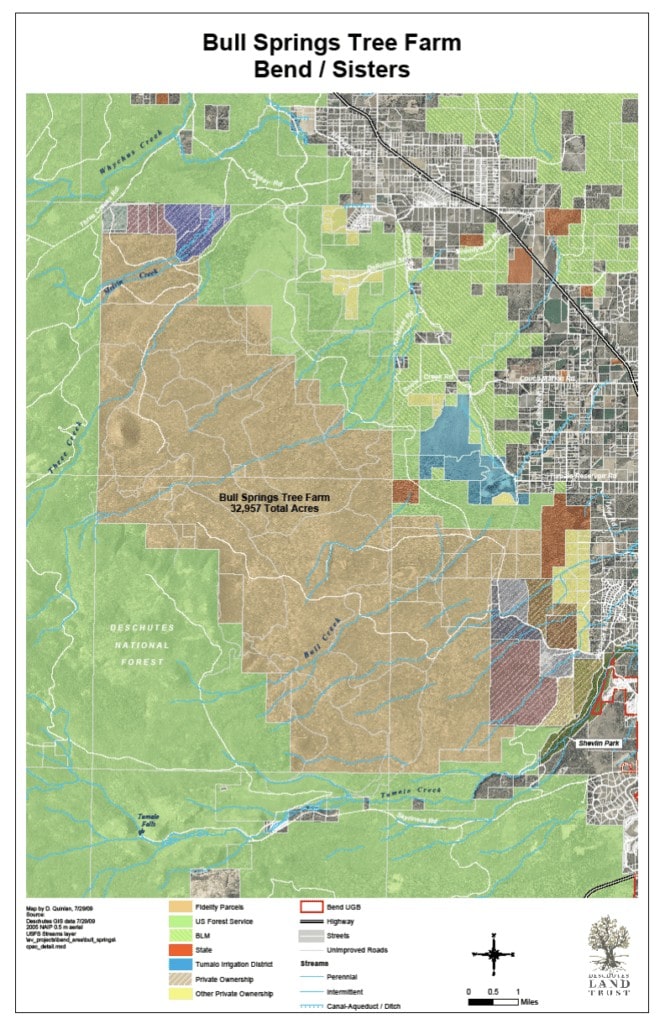
Skyline Forest (sometimes referred to as the Bull Springs Tree Farm) is an ~33,000 acre of private property that is commonly mistaken as public property but is actually privately held by the Shanda Corporation. It lies to the northwest of Bend and is roughly bounded by the Brooks Scanlon Haul Road on the east, Skyliners Road on the south, Three Creeks Road on the north and the Deschutes National Forest on the west.
Prior to the Fall of 2022, Shanda Corporation allowed public non-motorized recreational access. 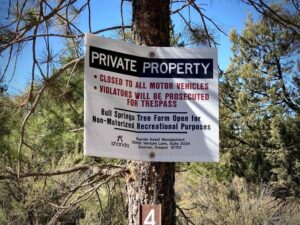 In the Fall of 2022, Shanda Corporation closed access to Skyline Forest due to extreme fire danger. Since that time, the forest has remained closed to public access, and it appears that it will remain closed indefinitely.
There are two organizations working towards saving Skyline Forest for public access: Central Oregon Land Watch and the Deschutes Land Trust. Click on the above links to learn more, a lot more!
In this podcast, we talk with Ben Gordon, the Executive Director of Central Oregon Land Watch, about Skyline Forest and this exact issue.
What Can I Do?
- Keep up to date with the latest information regarding the forest. One way to do this is to subscribe to the newsletters of Central Oregon Land Watch and/or the Deschutes Land Trust.
- Donate to Central Oregon Land Watch and/or Deschutes Land Trust. Each needs money to accomplish their missions. Deschutes Land Trust is currently working on finding a path toward purchasing the property or working with potential buyers to encourage conservation outcomes. They do this work quietly and behind the scenes in order to maintain a productive and trusting working relationship between our organization and the landowners/broker/potential buyers. Central Oregon Landwatch’s Save Skyline Forest campaign is focused on deterring buyers who don’t have conservation as part of their goals and also keeping the community energized and engaged.
- Advocate for preservation and proper use of the forest. Advocacy can include talking with your friends about the history, ownership, usage, and importance of the forest (wildlife migration, recreation, and land preservation).
- Be cognizant that Skyline Forest is private land and know the general boundaries of the forest.
